

The Riverland and South East Corner of South Australia includes towns such as Renmark and Mount Gambier and famous landmarks such as the River Murray and the Blue Lake. Gerard and Raukkan are part of this region.
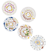
In the artwork depicting this area, the pelican circles high above the River Murray, while the hawk flies low to warn the people. The waterholes and interconnected caverns of the southeast travel for many kilometres below the earth’s surface. Wood engravings shine under the moon light and the Southern Cross constellation.

Gerard is a community located about 12 km northwest of Loxton and 182 km northeast of Adelaide. Located on the northern side of the River Murray, its boundaries were created in 1999.
Below are some statistics about Gerard:
- Population: 39 (approximately)
- Water usage: N/A
- Water supply: River Murray
- Water treatment method: Filtration and chlorination

Raukkan is located on the south-eastern shore of Lake Alexandrina about 80 km southeast of Adelaide.
Point McLeay Mission was established in 1859 and returned to the Ngarrindjeri people in 1974. It was renamed Raukkan in 1982. Raukkan means ‘meeting place’ in the Ngarrindjeri language, and this location was an important meeting place for thousands of years.
Below are some statistics about Raukkan (Pt McLeay):
- Population: 106 (approximately)
- Water usage: N/A
- Water supply: SA Water mains
- Water treatment method: SA Water treatment including chlorination / chloramination

