

The Adelaide region is the most populated and includes the state capital as well as Port Augusta, the Adelaide Hills and the Barossa Valley. The communities of Davenport and Point Pearce are located in this region.
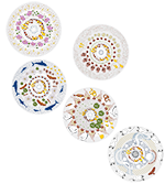
The artwork representing this region depicts Emu and Kangaroo visiting a centuries old waterhole on Kaurna Country. Large strands of stringy bark trees form the eastern border of Kaurna Country, while tufts of kangaroo grass grow westerly across the plains.
The Ibis is a significant cultural icon of the Kaurna people that can be found around wet areas. Cultural icons from neighbouring groups radiate out from the flames of the seasonal fires that burn brightly on Kaurna Country to regenerate the landscape.

Davenport Community is located about 3 km northeast of Port Augusta and around 300 km north of Adelaide.
The Corporate Town of Davenport has existed since 1887, but the modern suburb was created in 2014 by combining parts of the existing areas of Wami Kata and Port Augusta.
Below are some statistics about Davenport:
- Population: 150 (approximately)
- Water usage: N/A
- Water supply: SA Water mains
- Water treatment method: SA Water treatment including chlorination / chloramination

Point Pearce is located on South Australia’s Yorke Peninsula around 194 km northwest of Adelaide.
Home to the Narungga people, Point Pearce was established as a mission in 1868. The people of Point Pearce fought for control of the land for many years and it was finally granted in 1972.
Below are some statistics about Point Pearce:
- Population: 89 (approximately)
- Water usage: N/A
- Water supply: SA Water mains
- Water treatment method: SA Water treatment including chlorination / chloramination

