

This region incorporates the northeast and some of the central northern area of South Australia. The closest regional centre is Broken Hill, across the border in New South Wales. The famous Lake Eyre is also located in this region. Nepabunna and Umoona are part of this region.
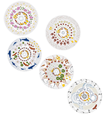
The artwork for this region depicts a mound spring bubbling water to the Earth’s surface amongst the rippled sand dunes. Sturt’s desert pea spectacularly displays an iconic carpet of red blooms across the landscape, while poached egg daisy flowers glisten in the morning sun near the Queensland border.

Nepabunna is located in the Northern Flinders Ranges, around 600 km north of Adelaide.
Nepabunna was established in the 1930s and is the current home of the Adnyamathanha people (who used to roam as far as Broken Hill).
Below are some statistics about Nepabunna:
- Population: 66 (approximately)
- Water usage: N/A
- Water supply: Bores (for non-drinking water) and rainwater from a catchment (drinking water)
- Water treatment method: UV treatment on drinking water only

Umoona community is part of Coober Pedy, located 846 km north of Adelaide
Below are some statistics about Umoona:
- Population: 40 (approximately)
- Water usage: N/A
- Water supply: Bores
- Water treatment method: Reverse osmosis and iron removal

