

The APY Lands region is located in the remote northwest of South Australia and includes the communities of Amata, Pukatja, Kaltjiti, Indulkana, Mimili, Pipalyatjara and Kanpi.
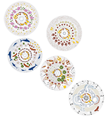
The artwork representing this region depicts the bush tomatoes and fruit that are in abundance throughout the APY Lands. Bush turkey tracks walk across the hot sand. Kangaroo and Emu come together at a desert waterhole to share fresh, cool and clean water.

Amata is located at the western end of the Musgrave Ranges (in South Australia), about 14 km south of the Northern Territory border. It is 115 km due south of Uluru (Ayers Rock) and 380 km south west of Alice Springs.
Amata was established as a cattle outstation in the 1960s to take some pressure from Pukatja (Ernabella) which was increasing in population growth.
Below are some statistics about Amata and some extra resources relating to water supply and treatment.
- Population: 273 (approximately)
- Water usage: 471 litres per person per day (12 month average)
- Number of bores: 6
- Water treatment method: UV treatment
What’s in the water - online book Amata
Read this online book to find out what’s in the water in Amata.
Bore-to-tap story - online book Amata
Read this online book to find out how the water gets from the bore to the tap in Amata.

Bore-to-tap water story - animated interactive (requires Flash) Amata
Watch this animated interactive to find out how the water moves from bore to tap in Amata.

Pukatja (Ernabella) is located in the Musgrave Ranges in South Australia, about 30km south of the Northern Territory border and 300 km south west of Alice Springs.
The land surrounding Pukatja has great cultural significance to the local community and nearby Umuwa (approximately 25 kms south of Pukatja) is the major administrative centre within the APY Lands.
Below are some statistics about Pukatja and some extra resources relating to water supply and treatment.
- Population: Between 600 and 650 (approximately)
- Water usage: 615 litres per person per day (12 month average)
- Number of bores: 6
- Water treatment method: UV treatment
Bore-to-tap water story - animated interactive (requires Flash) Pukatja
Watch this animated interactive to find out how the water moves from bore to tap in Pukatja.

Kaltjiti (Fregon) is located about 45 km south of the Musgrave Ranges and 137 km (by road) from the Indulkana community.
Kaltjiti was established in 1961, with government assistance, for the purpose of housing cattlemen and their families. An outstation, about 60 km south west of Ernabella, was created to train cattle workers and provide their families access to traditional country in the sand hills.
Below are some statistics about Kaltjiti and some extra resources relating to water supply and treatment.
- Population: 350 (approximately)
- Water usage: 582 litres per person per day (12 month average)
- Number of bores: 6
- Water treatment method: UV treatment and reverse osmosis
Bore-to-tap water story - animated interactive (requires Flash) Kaltjiti
Watch this animated interactive to find out how the water moves from bore to tap in Kaltjiti.

Indulkana (Iwantja) is located in the far north west of South Australia, about 575 km south of Alice Springs and 70 km east of Mimili.
Prior to the early 1970s, Indulkana land was used for farming purposes. It was not until the land was returned to its Traditional Owners, that the Indulkana community was re-established.
Below are some statistics about Indulkana and some extra resources relating to water supply and treatment.
- Population: 225 (approximately)
- Water usage: 287 litres per person per day (12 month average)
- Number of bores: 4 (two supply the reverse osmosis plant and two are used as back up).
- Water treatment method: UV treatment and reverse osmosis
Bore-to-tap water story - animated interactive (requires Flash) Indulkana
Watch this animated interactive to find out how the water moves from bore to tap in Indulkana.

Mimili is located in the north west of South Australia, about 645 km south of Alice Springs and 70 km west of the Indulkana community.
Prior to the early 1970s, when Mimili was returned to its Traditional Owners, the land housed the Everard Park Cattle Station. On this station, many of the older community members undertook jobs such as mustering, branding and droving horses.
Below are some statistics about Mimili and some extra resources relating to water supply and treatment.
- Population: 300 (approximately)
- Water usage: 179 litres per person per day (12 month average)
- Number of bores: 4
- Water treatment method: UV treatment and reverse osmosis
What’s in the water - online book Mimili
Read this online book to find out what’s in the water in Mimili.
Bore-to-tap story - online book Mimili
Read this online book to find out how the water gets from the bore to the tap in Mimili.
Bore-to-tap water story - animated interactive (requires Flash) Mimili
Watch this animated interactive to find out how the water moves from bore to tap in Mimili.

Pipalyatjara is located in the far north west of South Australia, about 200 km south west of Uluru (Ayers Rock).
Pipalyatjara is characterised by far reaching mountain ranges including the Musgraves, Mann and Tomkinsons which stretch east to west along the south side of the Northern Territory and South Australian border. Pipalyatjara is also home to isolated ranges, hills and sandhill plains.
Below are some statistics about Pipalyatjara and some extra resources relating to water supply and treatment.
- Population: 114 (approximately)
- Water usage: 591 litres per person per day (12 month average)
- Number of bores: 3
- Water treatment method: UV treatment and reverse osmosis
Bore-to-tap water story - animated interactive (requires Flash) Pipalyatjara
Watch this animated interactive to find out how the water moves from bore to tap in Pipalyatjara.
Kanpi is located about 460 km southwest of Alice Springs and is part of the Murputja homelands groups which includes Nyaperi, Angatja and Umpukulu.
Below are some statistics about Kanpi:
- Population: 35 (approximately)
- Water usage: N/A
- Water supply: Ground water
- Water treatment method: UV Filtration

